



Compra un plan
Elige destino, cantidad de datos y periodo de validez.





No hay fecha límite para el primer uso. Puedes comprar el plan ahora y guardarlo para un futuro viaje.
Elige tu plan para Nueva Zelanda según dos mitades muy distintas. La Isla Norte une Auckland y Rotorua por carretera directa; la Isla Sur conecta Christchurch y Queenstown por tierras altas y continúa a Fiordland. Compara precios, datos, validez y territorio. El rendimiento varía según el plan, teléfono, lugar exacto, roca o túnel sobre la carretera y red asociada que alcance cada valle.
Dos islas sin carretera entre ellas. Auckland es la mayor ciudad y la principal entrada internacional. Rotorua queda a unos 230 kilómetros al sur, en un campo geotérmico activo de géiseres, barro hirviendo y suelo humeante. La Isla Sur se alcanza en avión o ferry por el estrecho de Cook. Sus distancias también son largas: Christchurch–Queenstown son unos 485 kilómetros de tierras altas. Más allá de Te Anau, Fiordland tiene largos tramos sin localidades.
Política de reembolso
Siempre reembolsamos el importe total que pagaste cuando lo solicitas, tanto si tu eSIM no se ha usado como si se ha usado parcial o totalmente. No hay plazo límite para solicitar un reembolso.
Sin fecha límite de primer uso
La validez no empieza hasta que el eSIM se conecta a una red compatible en tu destino. No hay fecha límite para el primer uso. Puedes comprar el plan ahora y guardarlo para un futuro viaje.
Pago seguro
Tarjetas, Apple Pay y Google Pay, con cifrado de Paysera.
Soporte 24/7 en todos los idiomas
Respuestas instantáneas garantizadas.
Antes del vuelo, instala el perfil mediante una red Wi-Fi de confianza; el periodo de validez no empieza hasta que la eSIM se conecta por primera vez a una red móvil compatible en Nueva Zelanda. La terminal internacional de Auckland está a unos 21 kilómetros al sur del centro. AirportLink conecta el aeropuerto con la estación de Puhinui para continuar en tren y con Manukau; SkyDrive llega a SkyCity, en el centro de Auckland. También hay taxis y vehículos solicitados por aplicación. Consulta el planificador actual del operador para comprobar salidas y posibles autobuses que sustituyan a los trenes. Selecciona la eSIM como línea de datos móviles cuando lo indique tu plan y guarda sin conexión los detalles del ferry, el alquiler y el alojamiento para los tramos más aislados del interior.
Elige destino, cantidad de datos y periodo de validez.
Escanea el QR o instálalo automáticamente en la app: sin SIM física.
Los datos se activan con la primera conexión en tu destino.
Elige el perfil más parecido a tu viaje. La estimación asume un uso normal: mapas, mensajería, fotos y una llamada corta a casa.
Como referencia, una escapada urbana de 3–4 días gasta unos 1–3 GB, un viaje de una semana 3–5 GB, una ruta de dos semanas por varios países 8–12 GB, y trabajar de viaje consume alrededor de 1 GB al día, así que 15 GB o más para dos semanas.
En total, 3 GB de datos cubren aproximadamente 1000 fotos compartidas, 50 horas de redes sociales y navegación, 8,8 horas de videollamadas, 38 horas de música en streaming o unas 600 horas de mapas y navegación. Las apps de mensajería apenas gastan datos.
Auckland · Guía de la ciudad
Auckland es la mayor ciudad y la entrada internacional habitual. Sky Tower, el Museo Conmemorativo de Guerra de Auckland y Viaduct Harbour forman un centro peatonal. Waiheke y sus viñedos se alcanzan en ferry por aguas abiertas, donde el teléfono depende de la señal que llegue de la costa. El aeropuerto está a unos 21 kilómetros al sur.
eSIM de Auckland: configúralo antes de volarRotorua · Guía de la ciudad
Rotorua queda a unos 230 kilómetros de Auckland, dos horas y tres cuartos a tres por carretera directa. Te Puia y Wai-O-Tapu enlazan géiseres, piscinas de barro hirviendo y terrazas de colores mediante pasarelas. La aldea maorí Whakarewarewa y el lago Rotorua completan el día. El suelo humea entre las visitas: carga los mapas de los parques antes de entrar. El aeropuerto está a pocos kilómetros al sureste.
eSIM de Rotorua: configúralo antes de volarChristchurch · Guía de la ciudad
Christchurch, la Ciudad Jardín, reúne jardines botánicos, Cathedral Square, Riccarton House y la zona del tranvía histórico en el centro. Desde allí se abre Canterbury. El siguiente tramo importa para los datos: Queenstown está a unos 485 kilómetros y cinco horas y media a seis por tierras altas como Lindis Pass, que puede tener nieve de junio a agosto. El aeropuerto queda a unos 10 kilómetros al noroeste.
eSIM de Christchurch: configúralo antes de volarQueenstown · Guía de la ciudad
Queenstown se asienta junto al lago Wakatipu, con la góndola Skyline a Bob’s Peak, la cordillera Remarkables enfrente y la antigua localidad aurífera de Arrowtown cerca. El aeropuerto está a pocos kilómetros, en Frankton. Milford Sound es la gran excursión: unos 290 kilómetros por Te Anau y cuatro a cuatro horas y media por sentido, entre fiordos y el túnel Homer.
eSIM de Queenstown: configúralo antes de volarPor qué Horizon
Ajusta los datos a la forma del viaje. Dos o tres semanas por ambas islas incluyen aeropuertos, largas carreteras y una travesía, con el mapa abierto gran parte del día. Un circuito breve Auckland–Rotorua exige menos. Comprueba que la validez cubra el regreso y que Nueva Zelanda figure expresamente en el territorio del plan.
Plan para
Nueva Zelanda
Compara los volúmenes de datos y los periodos de validez publicados para tu destino.
Instálalo con una red Wi-Fi fiable antes de salir y sigue las instrucciones de activación del plan.
Revisa el precio actual, los datos, la validez y la cobertura antes de pagar. Los planes Horizon no tienen reducción de velocidad.
Cuando el plan seleccionado admite reutilización o recargas, Mis eSIM muestra las opciones elegibles para el perfil instalado.
Te avisaremos cuando te acerques a tu límite. Si el plan admite recargas, Mis eSIM muestra las opciones elegibles.
Elige cobertura por país, regional o global y comprueba cada destino en los detalles del plan.
Sí; dos o tres semanas es lo habitual. No hay carretera entre ellas: hay que incluir un vuelo Auckland–Christchurch de una hora y veinte o conducir a Wellington y tomar Interislander hasta Picton. Con menos de dos semanas suele eliminarse alguna zona, a menudo Fiordland, la más alejada de las entradas principales.
Sí. Homer mide 1.270 metros, con boca oriental a 945 de altitud y circulación alterna regulada por semáforos. La carretera cierra una media de ocho días al año en los meses fríos; el control de avalanchas se activa mediante helicóptero. Entre Te Anau y el fiordo hay largos tramos sin localidades: consulta el estado antes de salir.
Ambas son opciones habituales. El vuelo entre Auckland y Christchurch dura alrededor de una hora y veinte minutos. Para cruzar el estrecho de Cook, llega por tierra a Wellington, toma Interislander hasta Picton en unas tres horas y media y continúa el viaje. Si quieres llevar un coche de alquiler, confirma antes que la empresa lo permita y reserva el vehículo con el operador del ferry; no supongas que podrás conservar el mismo coche entre las islas. Guarda los detalles de la travesía y del siguiente trayecto sin conexión, porque la conectividad puede variar en mar abierto.
Conducir por cuenta propia es habitual en cada isla, pero requiere prepararse para circular por la izquierda y por carreteras desconocidas. Lee las indicaciones de NZ Transport Agency, planifica descansos y evita comenzar un trayecto largo con cansancio después de un vuelo. Las carreteras sinuosas y el tiempo cambiante pueden alargar los viajes más de lo que sugiere la distancia en línea recta: Christchurch–Queenstown son unos 485 kilómetros y de cinco horas y media a seis sin paradas. Compara vuelos o transporte organizado si conducir no te encaja, y cuenta con una travesía independiente entre las islas.
Christchurch es una entrada amplia, llana y céntrica para Canterbury y un circuito largo. Queenstown es la base alpina junto a Wakatipu, bajo Remarkables, y el punto de partida para Milford Sound, a unos 290 kilómetros por sentido vía Te Anau. Las dos ciudades están a unos 485 kilómetros o una hora de vuelo.
Las estaciones son opuestas a Europa y Norteamérica. Diciembre–febrero es el periodo más cálido; el baño se extiende aproximadamente de diciembre a marzo, aunque el agua es fresca para estándares tropicales. Junio–agosto es lo más frío y el esquí de Queenstown y Wanaka va de junio a septiembre. Noviembre y marzo ofrecen buenas condiciones y menos gente.
Sí, es la etapa breve habitual de la Isla Norte. Rotorua queda a unos 230 kilómetros y dos horas y tres cuartos a tres de Auckland, fácil de combinar en dos o tres noches antes de volar al sur. Auckland ofrece ciudad, museo y ferry a Waiheke; Rotorua, Te Puia, Wai-O-Tapu, Whakarewarewa y el lago. Ambas están en la ruta principal de la Isla Norte.
No. Los planes Horizon no tienen reducción de velocidad. No hay un límite diario que te frene, así que puedes usar todo el plan en un día si lo necesitas. La velocidad depende de la red local, de tu señal y de lo saturada que esté la red. Cuando se agotan tus datos, el plan se detiene en lugar de ir más lento.
Sí. Siempre reembolsamos el importe total que pagaste cuando lo solicitas, tanto si tu eSIM no se ha usado como si se ha usado parcial o totalmente. No hay plazo límite para solicitar un reembolso.
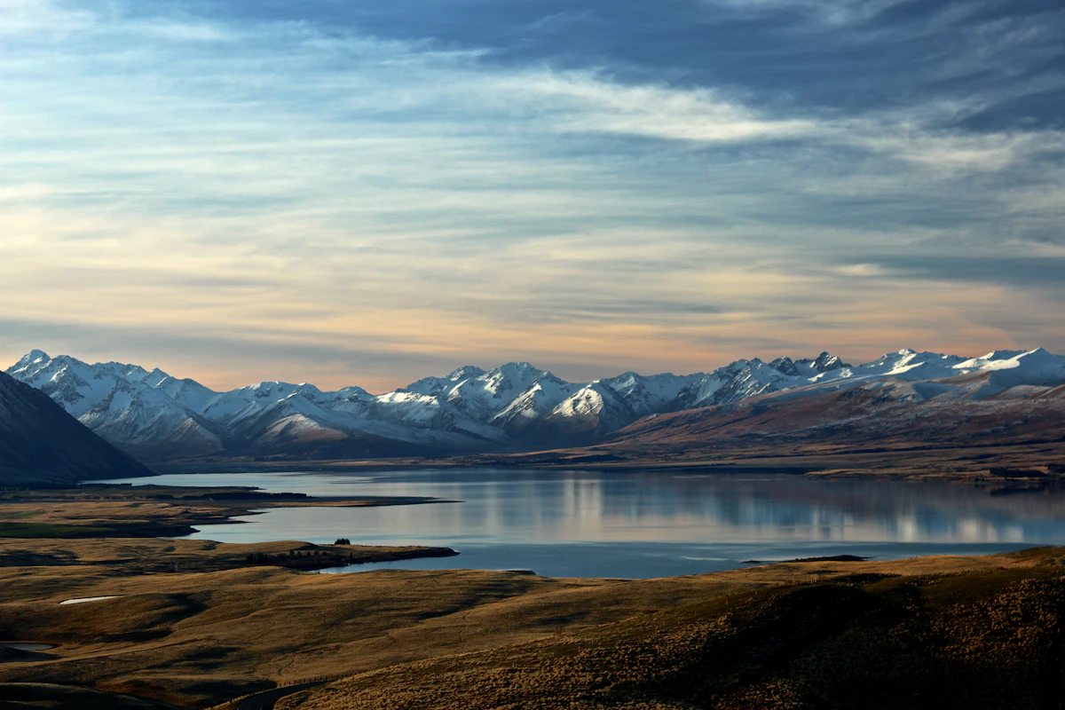
Elige una eSIM para Nueva Zelanda según tu ruta, consumo y fechas. Compara los planes actuales y comprueba después tu teléfono y las instrucciones de configuración.
Un fin de semana largo en una ciudad neozelandesa consume 2–4 GB; una semana de ruta, 6–10 GB; y dos semanas o un viaje por carretera, desde 12 GB. Conservas tu número australiano.
